


eTrex Owner’s Manual 19
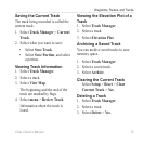
Navigation
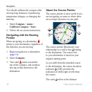
between dots on the course deviation
indicator.
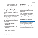
Navigating with the Course Pointer
Before you can navigate with the
course pointer, you must change the
pointer setting to Course (CDI)
(page 34).
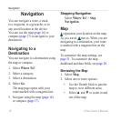
1. Begin navigation to a destination
(page 16).
2. Select Compass.
3. Use the course pointer to navigate
to the destination (page 18).
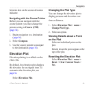
Elevation Plot
Elevation plotting is available on the
eTrex 30x.
By default, the elevation plot displays
the elevation for an elapsed time. To
customize the elevation plot, see
page 34.
Select Elevation Plot.
Changing the Plot Type
You can change the elevation plot to
display pressure and elevation over
time or distance.
1. Select Elevation Plot > menu >
Change Plot Type.
2. Select an option.
Viewing Details about a Point
on the Plot
Select an individual point on the
plot.
Details about the point appear at the
top of the plot.
Resetting the Elevation Plot
Select Elevation Plot > menu >
Reset > Clear Current Track >
Yes.