Garmin GPSMAP 695/696 Owner’s Manual
190-00919-00 Rev. D
114
Hazard Avoidance
OverviewGPS NavigationFlight PlanningHazard AvoidanceAdditional FeaturesAppendicesIndex
4.3 TRAFFIC INFORMATION SERVICE (TIS)
NOTE:
Refer to Appendix E for general information regarding TIS. Refer to
Appendix D for configuration information.
The GPSMAP 695/696 supports TIS input from a Garmin Mode S transponder, such
as the GTX 330.
TIS SYMBOLOGY
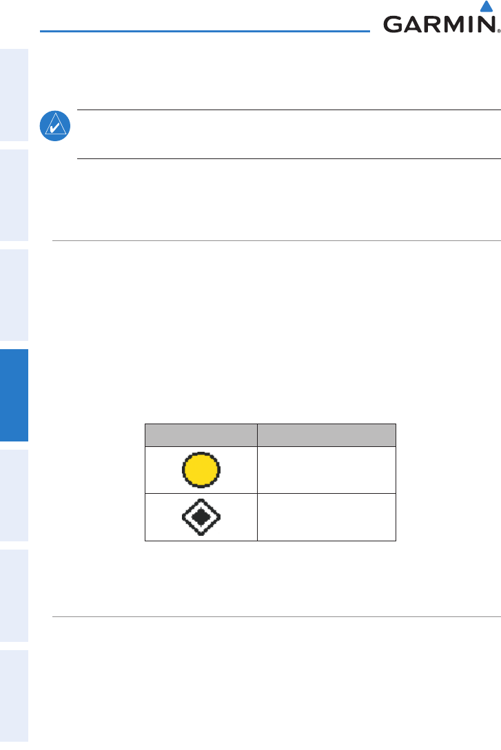
TIS traffic is shown on the GPSMAP 695/696 according to TCAS symbology,
graphically shown on the Map Page, and in the Traffic Warning Window. A Traffic
Advisory (TA) symbol appears as a solid yellow circle. All other traffic is shown as a
hollow white diamond. Altitude deviation from own aircraft altitude is shown above
the target symbol if traffic is above own aircraft altitude, and below the symbol if they
are below own aircraft altitude. Altitude trend is shown as an up arrow (>+500 ft/
min), down arrow (<-500 ft/min), or no symbol if less than 500 ft/min rate in either
direction.
TIS Symbol Description
Traffic Advisory (TA)
Other Traffic
TIS Traffic Symbols
TIS ALERTS
A TIS audio alert is generated whenever the number of Traffic Advisories on
the GPSMAP 695/696 screen increases from one scan to the next. Limiting Traf-
fic Advisories only reduces the “nuisance” alerting due to proximate aircraft. For
example, when the first Traffic Advisories appear on the TIS display, the user is alerted
audibly. So long as a single aircraft remains on the TIS display, no further audio alert
is generated. If a second (or more) aircraft appears on the screen, a new audio alert
is sounded.


