Garmin aera 795/796 Pilot’s Guide
190-01194-00 Rev. C
135
Hazard Avoidance
Overview GPS Navigation Flight Planning Hazard Avoidance Additional Features Appendices Index
DEDICATED TRAFFIC PAGE (TRF)
Altitude filter settings from the Traffic Page are carried to the Map Page.
Viewing the Traffic Page:
1)
From the Main Menu touch the Traffic Icon.
Changing the altitude range:
1)
On the Traffic Page, select the
Menu > Altitude Filter
.
2)
Select one of the following:
•
Unrestricted: All traffic is displayed.
•
Normal: Displays non-threat and proximity traffic from 2700 feet
above the aircraft to 2700 feet below the aircraft. Typically used during
enroute phase of flight.
•
Above: Displays non-threat and proximity traffic from 9000 feet
above the aircraft to 2700 feet below the aircraft. Typically used during
climb phase of flight.
•
Below: Displays non-threat and proximity traffic from 2700 feet
above the aircraft to 9000 feet below the aircraft. Typically used during
descent phase of flight.
FLIGHT ID DISPLAY
The Flight IDs of other aircraft (when available) can be displayed on the Traffic Page.
When a Flight ID or call sign is received, it will appear below the corresponding traffic
symbol when enabled.
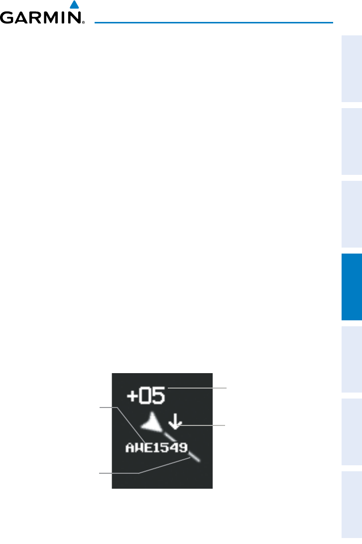
Aircraft
Identification (tail
number or Flight
ID number)
Example ADS-B Traffic Symbol
Traffic Absolute
Motion Vector
Relative Altitude (in
this case 500 feet
above own aircraft)
Altitude Trend (up
arrow indicates
climbing, down
arrow indicates
descending)
Enabling/Disabling Flight ID Display:
On
the Traffic Page, select
Menu > Enable/Disable Target Identifiers
.


