


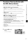
55
Using Location Data Functions/Displaying Maps
Using Location Data Functions/
Displaying Maps
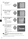
Select the z (location data options) menu (A47), and set Record location
data in Location data options to On, the camera starts receiving signals from
positioning satellites.
Location data reception can be checked on the
shooting screen.
• n or o: Signals are being received from
four or more satellites, or from three satellites,
and positioning is being performed.
• z: Signals are being received, but positioning
is not possible.
• y: Signals are not received.
Recording the Shooting Location Data on the Image
• When shooting while positioning is being performed, the obtained location data
(latitude and longitude) are recorded on the images to be shot.
• When Compass display in Electronic compass is set to On, a rough direction of
the shooting is also recorded.
Recording the Log
• When selecting Start log in Create log in the location data options menu, while
positioning is being performed, the location data of places you visit with the
camera is recorded at the certain interval.
• The recorded log (location data) can be displayed on the map, when you store the
log on the memory card and then select View log in the location data options
menu. To save the recorded log, end log recording in Create log and select Save
log.
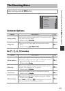
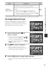
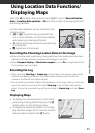
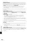
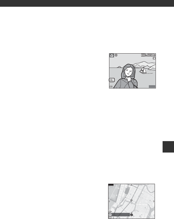
Displaying Maps
• To display the current position on the map if
positioning is being performed, press the U
(map) button on the shooting screen.
• To display the shooting location on the map,
play back the images which have the location
data recorded, and press the U button.
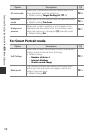
25
m
0s
25
m
0s
880
880
1/250
1/250
F3.7
F3.7
Current position
500m