


About Maps
With Maps, you can see your current location on the map,
browse maps of different cities and countries, search for
places, plan routes from one location to another, save
locations, and send them to compatible devices. You can also
purchase licences for traffic information and navigation
services, if available for your country or region.
When you use Maps for the first time, you may need to select
an internet access point for downloading maps.
If you browse to an area which is not covered by maps already
downloaded in your device, a map for the area is
automatically downloaded through the internet. Some maps
may be available in your device or on a memory card. You can
also use the Nokia Map Loader PC software to download
maps. To install Nokia Map Loader to a compatible PC, see
www.nokia.com/maps.
Tip: To avoid data transfer costs, you can also use Maps
without an internet connection, and browse the maps
that are saved in your device or memory card.
Note: Downloading maps may involve the
transmission of large amounts of data through your service
provider’s network. Contact your service provider for
information about data transmission charges.
Almost all digital cartography is inaccurate and incomplete
to some extent. Never rely solely on the cartography that you
download for use in this device.
For instructions on how to use the various features of Maps,
select
> Settings > Help > Help and Maps, or when
using Maps, select Options > Help.
Move on a map
When the GPS connection is active, shows your current
location on the map.
To zoom in to your current or last known location, select
Options > My position.
To move on the map, scroll up, down, left, or right with the
scroll key. The map is oriented towards north by default.
When you have an active GPS connection and browse the map
on the display, a new map is automatically downloaded if you
scroll to an area not covered by the maps that have already
been downloaded. The maps are automatically saved in the
device memory or on a compatible memory card, if inserted.
To zoom in and out on the map, press * and #.
To change the map type, select Options > Map mode.
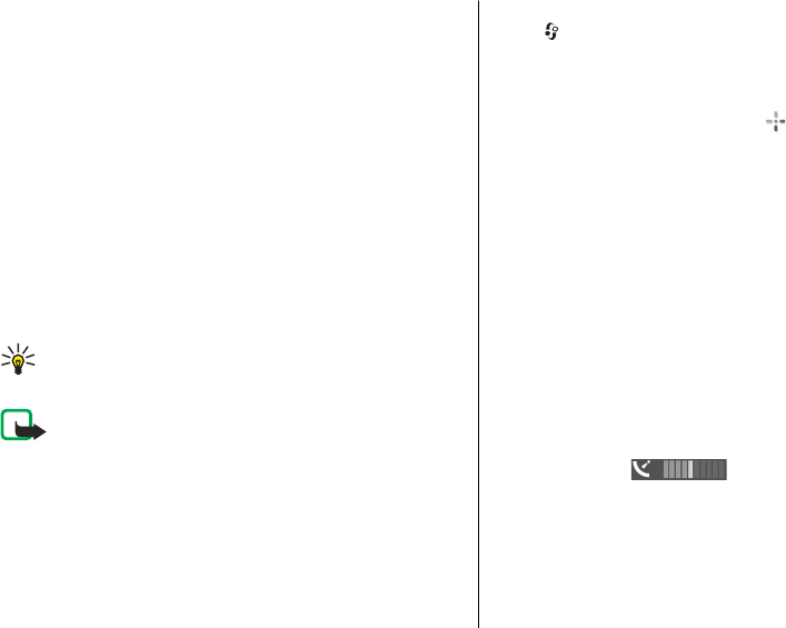
Display indicators
The GPS indicator shows the availability of the
satellite signals. One bar is one satellite. When the device tries
to find satellite signals, the bar is yellow. When the device
receives enough data from the satellites for GPS to calculate
your location, the bar turns green. The more green bars, the
more reliable the location calculation.
Initially, your device must receive signals from at least four
satellites to calculate the coordinates of your location. After
Positioning
© 2009 Nokia. All rights reserved. 31