


the initial calculation, signals from three satellites may be
enough.
The data transfer indicator
shows the internet
connection used, and the amount of data transferred since
the application started.
Landmarks
Select > Applications > Landmarks.
With Landmarks, you can save the position information of
specific locations in your device. You can sort the saved
locations into different categories, such as business, and add
other information to them, such as addresses. You can use
your saved landmarks in compatible applications, such as GPS
data.
GPS coordinates are expressed in the degrees and decimal
degrees format using the international WGS-84 coordinate
system.
Select Options and from the following:
● New landmark — Create a new landmark. To make a
positioning request for your current location, select
Current position. To select the location from map, select
Select from map. To enter the position information
manually, select Enter manually.
● Edit — Edit or add information to a saved landmark (for
example, a street address).
● Add to category — Add a landmark to a category in
Landmarks. Select each category to which you want to add
the landmark.
● Send — Send one or several landmarks to a compatible
device. Your received landmarks are placed in the Inbox
folder in Messaging.
You can sort your landmarks into preset categories, and
create new categories. To edit and create new landmark
categories, open the categories tab, and select Options >
Edit categories.
GPS data
Route guidance
Select > Settings > Connectivity > GPS data and
Navigation.
Start the route guidance outdoors. If started indoors, the GPS
receiver may not receive the necessary information from the
satellites.
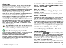
Route guidance uses a rotating compass on the device
display. A red ball shows the direction to the destination, and
the approximate distance to it is shown inside the compass
ring.
Route guidance is designed to show the straightest route and
the shortest distance to the destination, measured in a
straight line. Any obstacles on the route, such as buildings
and natural obstacles, are ignored. Differences in altitude are
not taken into account when calculating the distance. Route
guidance is active only when you move.
To set your trip destination, select Options > Set
destination and a landmark as the destination, or enter the
latitude and longitude coordinates.
Positioning
© 2009 Nokia. All rights reserved.32