


14. Tools
Select Menu > Tools.
The Tools folder contains applications used to configure your device and to configure other applications.
Memory card—See "Memory card," p. 18.
Transfer—See "Transfer content between devices," p. 17.
Profiles—See "Profiles," p. 16.
Settings—See "Settings," p. 68.
Positioning
With the positioning service you can receive information from service providers about local issues such as weather or traffic
conditions, based on the location of your device (network service).
Select Menu > Tools > Positioning.
To select a positioning method, scroll to the positioning method, and select Options > Enable. To stop using it, select Options >
Disable. The Bluetooth positioning method enables you to use Bluetooth GPS enhancements for positioning.
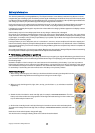
Navigator
This feature is not designed to support positioning requests for related calls. Contact your service provider for more information
about how your phone complies with government regulations on location based emergency calling services.
GPS should not be used for precise location measurement, and you should never rely solely on location data from the GPS receiver.
Select Menu > Tools > Navigator.
Navigator is a GPS application that enables you to view your current location, find your way to a desired location, and track
distance. The application requires a Bluetooth GPS accessory to operate. You must also have Bluetooth GPS positioning method
enabled in Menu > Tools > Positioning.
The application must receive positioning info from at least three satellites to use it as a traveling aid.
Select from the following:
• Navigator — View navigating information to your trip destination.
• Position — View positioning information about your current location.
• Trip dist. — View your traveling information such as the distance and duration you have traveled and your average and
maximum speeds.
Navigation view
The navigation view guides you to your trip destination. The cardinal points are indicated by letters on the circle, and the general
direction to your destination by a deeper color.
Select from the following:
• Set destination — Select a landmark or location as the destination of your trip, or enter the destination latitude and longitude
coordinates.
• Stop navigation — Delete the destination set for your trip.
• Save position — Save your current position as a location or landmark.
• Satellite status — View the signal strength of the satellites that provide the positioning info necessary for navigation.
• Saved locations — View the locations you have temporarily saved in your device to help in navigation.
Position view
View positioning info such as the latitude and longitude coordinates and altitude of your current location. You can also see the
accuracy of this info.
Select from the following:
• Save position — Save your current position as a location or landmark.
• Satellite status — View the signal strength of the satellites that provide the positioning info necessary for navigation.
• Saved locations — View the locations you have temporarily saved in your device to help in navigation.
Trip distance view
The trip meter calculates the travelled distance and time and your average and maximum traveling speeds.
Select from the following:
Copyright © 2006 Nokia. All Rights Reserved. 73