


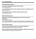

Terrain view — View at a glance the ground type, for example, when you are
travelling off-road.
3D view — For a more realistic view, change the perspective of the map.
Landmarks — Display prominent buildings and attractions on the map.
Night mode — Dim the colours of the map. When travelling at night, the map is
easier to read in this mode.
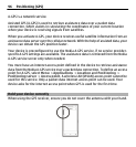
Download and update maps
To avoid mobile data transfer costs, download the latest maps and voice guidance
files to your computer, and then transfer and save them to your device.
Use the Nokia Ovi Suite application to download the latest maps and voice guidance
files to your compatible computer. To download and install Nokia Ovi Suite on your
compatible computer, go to www.ovi.com.
Tip: Save new maps to your device before a journey, so you can browse the maps
without an internet connection when travelling abroad.
To make sure your device does not use an internet connection, in the main menu,
select
> Internet > Connection > Offline.
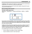
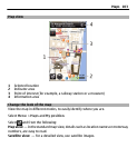
About positioning methods
Maps displays your location on the map using GPS, A-GPS, WLAN, or cell ID based
positioning.
The Global Positioning System (GPS) is a satellite-based navigation system used for
calculating your location. Assisted GPS (A-GPS) is a network service that sends you
GPS data, improving the speed and accuracy of the positioning.
Wireless local area network (WLAN) positioning improves position accuracy when
GPS signals are not available, especially when you are indoors or between tall
buildings.
104 Maps