


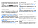
Initially, your device must receive signals from at least four
satellites to calculate the coordinates of your location. After
the initial calculation, signals from three satellites may be
enough.
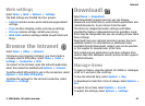
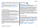
The data transfer indicator
shows the internet
connection used and the amount of data transferred since
the application started.
Find locations
To find a location in the city or area displayed on the map,
enter the full or partial address of the location in the search
field, and press the scroll key. To find a location in another
city, enter the city and the full or partial address, such as
London Oxford Street, and press the scroll key.
To find a specific address, or an address in another country,
press the scroll key, and select Search > Addresses.
Country/Region * and City or post code are mandatory.
Tip: To search for locations in another country using
the search field, enter also the name of the country in
the search field: Rome Italy.
To import a location address from the Contacts application,
press the scroll key and select Search > Addresses >
Options > Contact.
The search results are grouped by categories. To limit the
search to one category, select Options > Search.
If you search for locations without an internet connection,
the search results are limited to a radius of 50 km (31 miles).
Plan a route
To plan a route, select your start point on the map or search
for a location, press the scroll key, and select Add > To
route.
To define the destination and add more locations for your
route, search for the location, and select Options > Add
route point.
To show the route on the map, select Options > Show
route.
To navigate to the destination by car or on foot, if you have
purchased a licence for these extra services, select Options >
Start driving or Start walking.
To save the route, select Options > Save route.
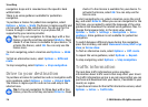
Walk to your destination
The walking route ignores any possible limitations to car
navigation, such as one-way streets and turn restrictions, and
includes areas such as pedestrian zones and parks. It also
prioritises walkways and smaller roads, and omits highways
and motorways.
The route is drawn to the map, and the arrow indicates the
direction. The small dots show in which direction you are
walking.
The length of a walking route is limited to a maximum of 50
kilometres (31 miles) and the travelling speed to a maximum
of 30 km/h (18 miles/h). If the speed limit is exceeded,
Travelling
© 2008 Nokia. All rights reserved. 75