10 GPSMAP 5000 Series Owner’s Manual
uSInG chartS
usInG
charts
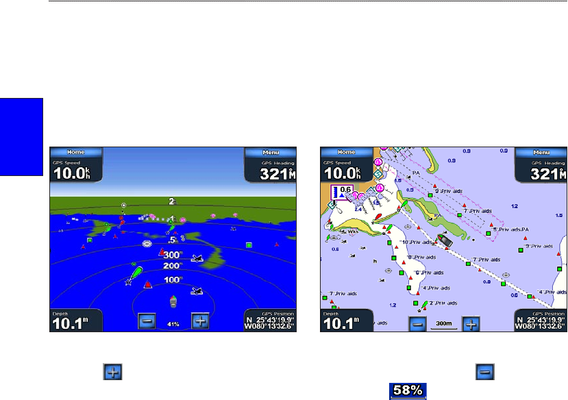
Using Mariner’s Eye
Mariner’s Eye provides an angled perspective from above and behind the boat (according to
your course), and provides a visual navigation aid. This view is helpful when navigating tricky
shoals, reefs, bridges, or channels, and is benecial when trying to identify entry and exit routes in
unfamiliar harbors or anchorages.
To access the Mariner’s Eye screen from the Home screen, touch Charts > Mariner’s Eye.
Mariner’s Eye Navigation Chart
Touch the button to view closer to your boat and lower to the water. Touch the button to
move the view away from the boat. This is indicated by the scale ( ) at the bottom of the
screen.
Mariner’s Eye Settings
To access additional settings or options from the Mariner’s Eye screen, touch Menu.
Rings—toggles the range rings on or off.
Tracks—turns the visible tracklog on or off. The unit continues to record tracks if you turn this
setting off, but they are hidden from view.
Safe Depth
—adjusts the depth at which red indicates shallow water. This feature is only available
with an optional BlueChart g2 Vision SD card.
Lane Width
—adjusts the width of the course line drawn on the screen when navigating using Go To
navigation. This setting does not affect routes (Route To) or automatic guidance (Guide To).


