16 GPSMAP 5000 Series Owner’s Manual
uSInG chartS
usInG
charts
Wrap—continuously records the track log, wrapping through the available memory
(replacing the oldest track data with new data).
Interval—denes the frequency at which the track plot is recorded. Recording more frequent
plots is more accurate, but lls the track log faster.
Interval—sets whether the interval is determined by distance, time, or resolution. (Press
Change to set the quantity.)
Distance—records the track based on a distance between points.
Time—records the track based on a time interval.
Resolution—records the track plot based on a variance from your course. This setting is
recommended for the most efcient use of memory. The distance value is the maximum
error allowed from the true course before recording a track point.
Change—Sets the value of the interval.
Color—sets the color of the track plot.
To edit or delete a saved track:
1. From the Home screen, touch Information > User Data > Tracks > Saved Tracks.
2. Touch the track you want to edit or delete.
3. Touch Edit Track to change the name or color of the track or to delete it.
Using Fishing Charts
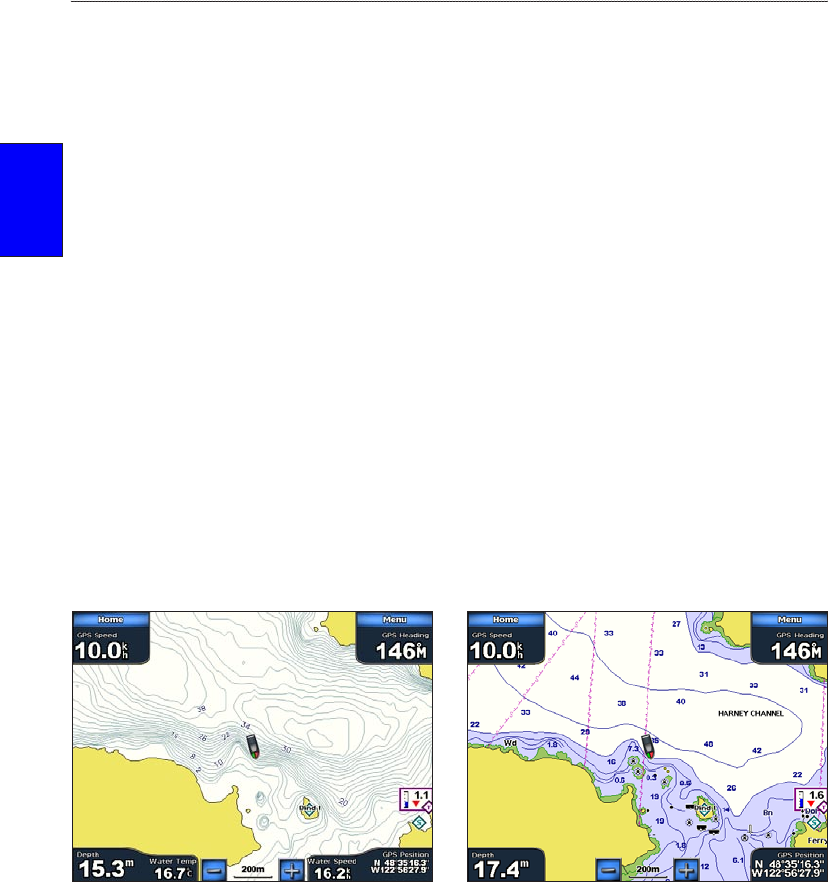
Use the shing chart for a detailed view of the bottom contours and depth soundings on the chart.
Fishing Chart Navigation Chart
The shing chart uses detailed bathymetric data on a preprogrammed BlueChart g2 Vision SD card,
and is best for offshore deep-sea shing.
Enabling High ResolutionHigh Resolution Satellite Imagery
You can overlay high-resolution satellite images on the land, sea, or both portions of the Navigation
chart when using a preprogrammed BlueChart g2 Vision SD card.
To enable satellite imagery:
1. While viewing the Navigation Chart, touch Menu > Chart Setup > Appearance > Photos.
2. Touch one of the following:
Off—standard chart information is shown on the map.
Land Only—standard chart information is shown on water with photos overlaying the land.
Blend—photos overlay both the water and the land at a specied opacity. The higher you
set the percentage, the more the satellite photos cover both land and water.
•
•
•
•
•
•
•
•
•
•
•


