


To set the device to ask your permission before connecting
to the internet, select Options > Tools > Settings >
Internet > Go online at start-up > Always ask.
To be informed when your device registers to a network other
than your home network, select Options > Tools >
Settings > Internet > Roaming warning > On (shown
only when you are online). For details and roaming costs,
contact your service provider.
Tip: To avoid data transfer costs, you can also use Maps
without an internet connection, and browse the maps
that are saved in your device or memory card.
Almost all digital cartography is inaccurate and incomplete
to some extent. Never rely solely on the cartography that you
download for use in this device.
Move on a map
The map coverage varies by country and region.
When you open Maps, the capital of the country you are in or
the location that was saved from your last session is shown.
The map of the location is also downloaded, if needed.
To zoom in to your GPS position or your last known location,
press 0.
When the GPS connection is active,
shows your current
location on the map.
To move on the map, scroll up, down, left, or right with the
scroll key. The map is oriented towards north by default.
To zoom in and out on the map, press * and #.
When you browse the map on the display, a new map is
automatically downloaded if you scroll to an area which is
not covered by maps already downloaded. These maps are
free of charge, but downloading may involve the
transmission of large amounts of data through your service
provider's network. For more information on data
transmission charges, contact your service provider. The
maps are automatically saved in the device memory or on a
compatible memory card (if inserted).
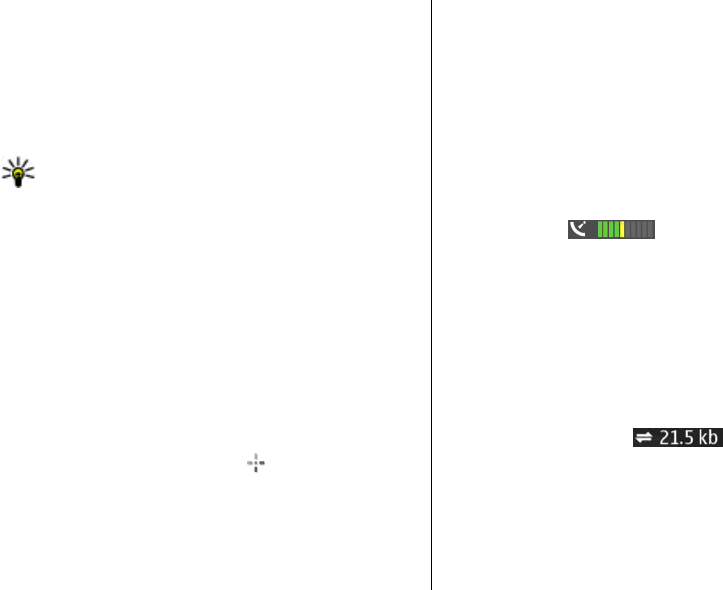
Display indicators
The GPS indicator on the bottom right corner of
the display shows the availability and strength of the satellite
signal. One bar is one satellite. When the device tries to find
a satellite, the bar is yellow. When the device receives enough
data from the satellite to establish a GPS connection, the bar
turns green. The more green bars, the stronger the GPS
connection.
Initially, your device must receive signals from at least four
satellites to calculate the coordinates of your location. After
the initial calculation, signals from three satellites may be
enough.
The data transfer indicator
shows the internet
connection used and the amount of data transferred since
the application started.
Find locations
To find a location in the city or area displayed on the map,
enter the full or partial address of the location in the search
© 2007 Nokia. All rights reserved.86