


Applications and Development 154
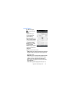
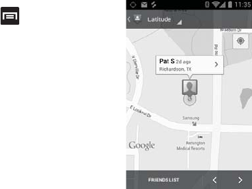
Latitude Options
From MAP VIEW, press
and select one of the
following:
• Clear Map
: allows you to
remove all markings and
layers from the map.
• Make available offline:
lets you
store up to six large metro areas
on your device for access when
you don't have a connection.
•Search
: allows you to search
for a place of interest.
•Directions
: displays navigation
directions to a location from a
starting point.
• Layers
: allows you to switch map views:
–
Traffic
: (available only in selected areas) Real-time traffic conditions are
displayed over roads as color-coded lines. Each color represents how
fast the traffic is moving.
–
Satellite
: Maps uses the same satellite data as Google Earth. Satellite
images are not real-time. Google Earth acquires the best imagery
available, most of which is approximately one to three years old.
–
Terrain
: combines a topographical view of the area’s terrain with the
current map location.
–
Transit Lines
: displays the overlapping transit lines on your map.
Latitude - MAPS VIEW