


Google Apps 159
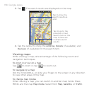
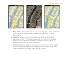
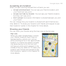
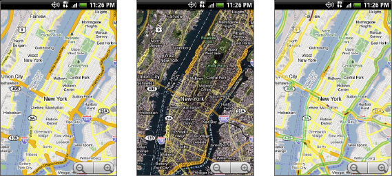
Traffic modeMap mode Satellite mode
Map mode This is the default view and displays a map, complete
with names of streets, rivers, lakes, mountains, parks, and
boundaries.
Satellite mode Google Maps uses the same satellite data
as Google Earth™. Satellite images are not real-time. Google
Earth acquires the best imagery available, most of which is
approximately one to three years old.
Traffic mode (available only in selected areas) Real-time traffic
conditions are displayed over roads as color-coded lines. Each
color represents how fast the traffic is moving.
•
•
•