10 - VNAV
195
190-00357-00 Rev H
Section 10
Vertical Navigation (VNAV)
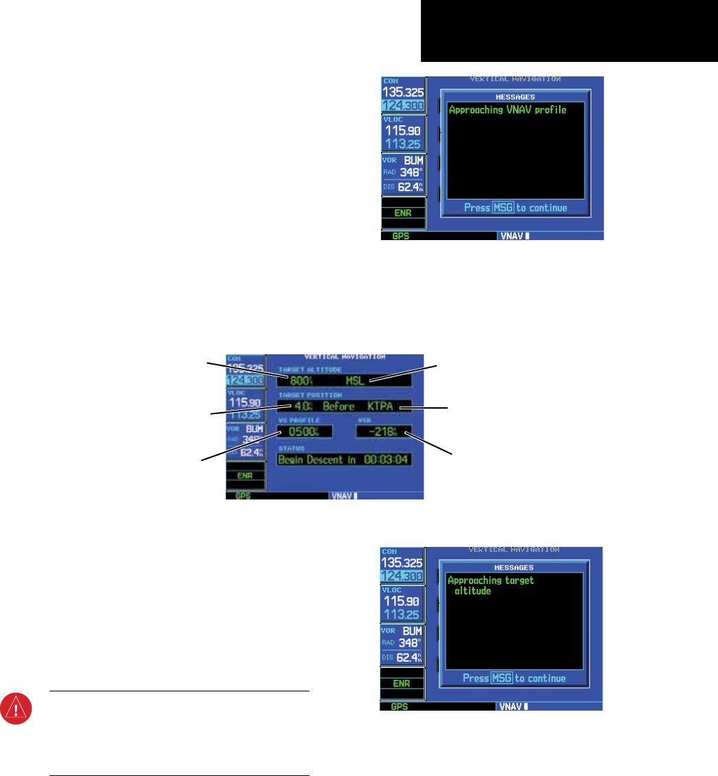
The 500W-series Vertical Navigation Page allows
you to create a three-dimensional profile which guides
you from your present position and altitude to a final
(target) altitude at a specified location. This is helpful
when you’d like to descend to a certain altitude near
an airport. Once the profile is defined, message alerts
and additional data on the Default NAV and Map
Pages keep you informed of your progress.
To display the Vertical Navigation Page, press the
VNAV key.
VNAV is inhibited in the following conditions:
• Groundspeedislessthan35knots
• Noactiveightplanordirect-todestination
• SUSPmode
• Vectors-to-Finalmode
• VLOCmode
• AftertheFAFonanapproach
WARNING: VNAV is to be used for advisory
purposes only. VNAV messages or vertical speed
required should not be used to maintain terrain
or ATC clearances. Terrain and ATC clearances are
the sole responsibility of the pilot.
Vertical Navigation Page
Target Altitude
Vertical Speed Desired
Altitude Reference
(AGL or MSL)
Vertical Speed Required
Target Distance
(from reference)
Target Reference
A message alert lets you know when to
begin a VNAV descent...
...as well as when you’re approaching your
new target altitude.


