10 - VNAV
189
190-00357-00 Rev C
Section 10
Vertical Navigation (VNAV)
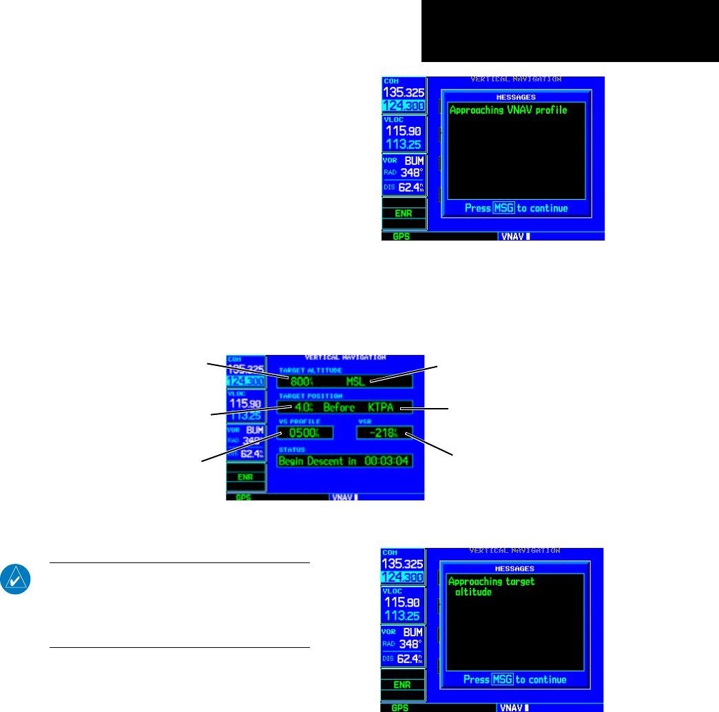
The 500W-series VerticalNavigationPageallows
you to create a three-dimensional profile which guides
you from your present position and altitude to a final
(target) altitude at a specified location. This is helpful
when you’d like to descend to a certain altitude near
an airport. Once the profile is defined, message alerts
andadditionaldataontheDefaultNAVandMap
Pages keep you informed of your progress.
To display the Vertical Navigation Page, press the
VNAV key.
NOTE: To use the vertical navigation features,
your ground speed must be greater than 35 knots
and you must be navigating to a direct-to desti-
nation or using a flight plan, and not be in SUSP
mode.
Vertical Navigation Page
Target Altitude
Vertical Speed Desired
Altitude Reference
(AGL or MSL)
Vertical Speed Required
Target Distance
(from reference)
Target Reference
A message alert lets you know when to
begin a VNAV descent...
...as well as when you’re approaching your
new target altitude.


