


Maps 228
NOUG-2.1-update1-105 Nexus One User’s Guide
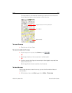
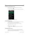
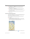
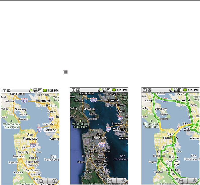
Changing map layers
Initially, Google Maps opens with a street map. You can also view a satellite image of a
location, check on traffic, and even look at a location as if you were standing on the
street. And you can view maps that you’ve created in Google Maps on the web. These
and many other layers are available in Google Maps.
To view map, satellite, or traffic layers
S Press Menu , touch Layers, and touch Traffic, Satellite, Latitude, or
another layer.
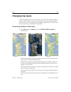
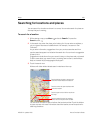
Map layer is the default. It displays a street map with the names of streets, rivers,
lakes, mountains, parks, and other features.
Satellite layer uses the same satellite data as Google Earth. Satellite images are
not real time. Google Earth acquires the best imagery available, most of which is
between 1 and 3 years old.
Traffic layer offers real-time traffic conditions, displayed over roads as color-coded
lines, from green through black.
For information about Latitude, see “Finding your friends with Google Latitude” on
page 238.
For information about the other features of Google Maps, visit Google Maps on the
web.
Map layer Satellite layer Traffic layer