40
Map Page
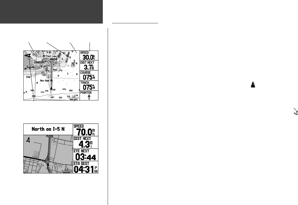
Map Page ( Marine Mode)
shown with optional BlueChart data
Data Fields
Map Scale
Current Location
LandWater Navaids
Map Page ( Automotive Mode)
shown with optional MapSource data
Using the Map Page
The Map Page provides a comprehensive display of electronic cartography, plotting, and navigational
data. When using the unit with optional MapSource BlueChart data (in Marine Mode), the map display
shows your location on a digital chart, complete with geographic names, map items, navaids and a host
of other chart features. In Automotive Mode, more detailed map features are available with other op-
tional MapSource data, such as City Select. The Map Page also plots your track and displays any routes
and waypoints you create. An on-screen cursor lets you pan and scroll to other map areas, determine the
distance and bearing to a position, and perform various route and waypoint functions.
Two basic map operating modes, position mode and cursor mode, determine what cartography is
shown on the map display. Position mode pans the cartography to keep the present position marker
within the display area. The position marker is the black triangle vehicle icon that shows your travel
on the Map Page. The GPSMAP 276C always powers up in the position mode, with the last known loca-
tion centered on the map display.
The GPSMAP 276C enters cursor mode when the ARROW KEYPAD is pressed. Cursor mode pans
the cartography to keep the cursor within the display area. The cursor is the white pointer arrow icon
used for panning around the Map Page. When the cursor is active, an additional data window appears at
the top of the screen to indicate the position, range, and bearing to the cursor or a selected waypoint or
map item.
Main Pages
190-00335-00_0A.indd 40 4/7/2004, 1:50:35 PM


