50
Main Pages
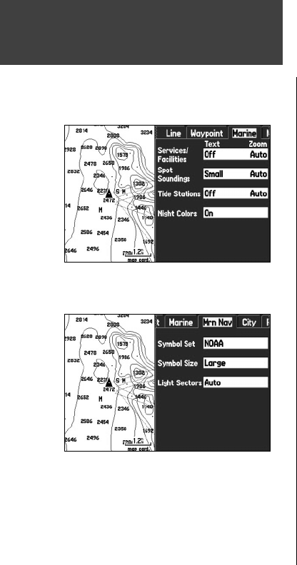
‘Marine’ tab
Services/Facilities, Spot Soundings, Tide Stations, Night Colors – controls the text size and zoom
scale for marine map items.
Text – Off, Small, Medium, and Large: controls the screen size of the name.
Zoom – Auto, Off, 20 ft. to 800 nm/mi: sets the maximum scale at which the feature appears on the
screen. Some types of data are only displayed to certain zoom scales.
‘Mrn Nav’ (Marine Navaids) tab
Symbol Set – controls which symbol set to use:
• Auto: BlueChart maps are drawn using symbols similar to the NOAA/NIMA standard. Non-
BlueChart maps are drawn using traditional Garmin symbols.
• Garmin: All maps are drawn using traditional Garmin symbols.
• NOAA: All maps are drawn using a symbol set similar to NOAA/NIMA.
• International: All maps are drawn using a symbol set similar to the IALA symbol set.
Symbol Size – Small, Medium, and Large: controls the size of the symbols.
Light Sectors – Off, Auto, On:
‘City’ tab
Large City, Medium City, Small City, Small Town – controls the text size and zoom scale for cities.
Text – Off, Small, Medium, and Large: controls the screen size of the name.
Zoom – Auto, Off, 20 ft. to 800 nm/mi: sets the maximum scale at which the cities appear on the
screen. Some types of data are only displayed to certain zoom scales.
Map Page
Marine Tab of Map Page Setup Menu
Mrn Nav Tab of Map Page Setup Menu
190-00335-00_0A.indd 50 4/7/2004, 1:50:44 PM


