


received enough data from the satellite signal to
calculate the coordinates of your location, the bar
turns black.
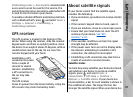
Initially your device must receive signals from at
least four satellites to be able to calculate the
coordinates of your location. When the initial
calculation has been made, it may be possible to
continue calculating the coordinates of your
location with three satellites. However, the
accuracy is generally better when more satellites
are found.
Position requests
You may receive a request from a network service
to receive your position information. Service
providers may offer information about local topics,
such as weather or traffic conditions, based on the
location of your device.
When you receive a position request, a message is
displayed showing the service that is making the
request. Select Accept to allow your position
information to be sent or Reject to deny the
request.
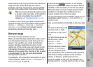
Maps
About Maps
Press
, and select Maps.
With Maps, you can see your current location on the
map, browse maps for different cities and countries,
search for addresses and different points of interest,
plan routes from one location to another, and save
locations as landmarks and send them to
compatible devices.
You can also purchase extra services, such as guides
and a turn-by-turn navigation service with voice
guidance.
Maps uses GPS. You can define the positioning
methods used with your device in the device
settings. See "Positioning settings," p. 147. For the
most accurate location information, use either the
internal GPS or a compatible external GPS receiver.
When you use Maps for the first time, you may need
to define an internet access point for downloading
map information for your current location. To
change the default access point later, select
Options > Settings > Network > Default
access point.
Almost all digital cartography is inaccurate and
incomplete to some extent. Never rely solely on the
cartography provided for use in this device.
88
Positioning (GPS)