


Web and Social Networking 73
• Advanced settings
:
–
Select search engine
: Select your default search engine (Google,
Yahoo!, or Bing).
–
Website settings
: View and manage settings for individual websites.
–
Reset to default
: Clear all browser data and reset all settings to the
factory defaults.
Maps
Use Google Maps to find your current location, get directions, and
other location-based information.
Note:
You must enable location services to use Maps, and some features
require Standalone or Google location services. (For more information,
refer to “Location & security” on page 124.)
You can locate selected friends and share your location with them
using Latitude. (For more information, refer to “Latitude” on page 101
and to “Maps” on page 73.)
ᮣ
Navigate to a Home screen panel, then touch
Applications
➔
Maps
.
Navigating the Map
Zooming
•
Double-tap on the screen to zoom in.
•
Touch Zoom in or Zoom out.
Scrolling
•
Touch and drag on the screen to reposition the map in the display.
Touch and Touch and hold
•
Touch and hold
on an area of the map to display pop-up information
about the location.
•
Touch
a pop-up for these options:
–
What’s nearby
: Display nearby points of interest.
–
Search nearby
: Enter search criteria to find nearby points of interest.
–
Share this place
: Shares this location as a message, sends to a Bluetooth
enabled device, sends this location as an Email or Gmail.
–
Report a problem with the map
: Send an error report to Google Maps.
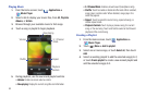
Maps Menu
1. Navigate to a Home screen panel, then touch
Applications
➔
Maps
.
2. Locate the top row of the applications to access additional
options:
•Map options
: displays a list of application shortcuts such as
Map
,
Places
,
Navigation
,
Latitude
,
Location history
, and
My Places
.
• Search Maps
: allows you to search for a place of interest.
•Layers
: allows you to switch map views:
–
Traf fic
: (available only in selected areas) Real-time traffic conditions are
displayed over roads as color-coded lines. Each color represents how
fast the traffic is moving.
–
Satellite
: Maps uses the same satellite data as Google Earth. Satellite
images are not real-time. Google Earth acquires the best imagery
available, most of which is approximately one to three years old.