


Applications and Development 121
Important!:
Before using Google Maps you must have an active data (3G/4G)
or Wi-Fi connection. The Maps application does not cover every
country or city.
ᮣ
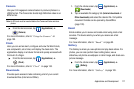
From the Home screen, tap (
Applications
)
➔
(
Maps
).
Important!:
For best results, it is recommended that you enable all of your
location services. For more information, refer to “Location and
Security” on page 167.
Enabling a Location source
Before you use Google Maps and find your location or search for
places of interest, you must enable a location source. To enable
the location source you must enable the wireless network, or
enable the GPS satellites.
Important!:
The more location determining functions are enabled, the more
accurate the determination will be of your position.
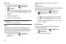
1. Press ➔ and then tap (
Settings
) ➔
Location and security
.
2. Tap
Use wireless networks
to enable GPS to determine
location based on nearby cell towers.
3. Tap
Use GPS satellites
to enable the GPS satellite.
4. Tap
Use sensor aiding
to enhance positioning and save
power using sensors.
Tip:
When using Google Maps you can turn on Enable GPS satellites.
Selecting GPS satellites allows you to locate places of interest at the
street-level. However, this also requires a clear view of the sky and uses
more battery power.
Opening Maps
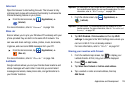
1. From the Home screen, tap (
Applications
)
➔
(
Maps
).
2. Locate the top row of the applications to access additional
options:
• Search Maps -
Allows you to search for a place of interest.
• Places -
Provides access to the places menu where you can
quickly locate a business or person, find out more information
about a business, see coupons, public responses, and more
(page 129). Locate and tap one of the listed places (
Restaurants
,
Coffee
,
Bars
,
Attractions
,
ATMs
,
Gas
Stations
,
Explore
Nearby
, or
Add
your own place). A list of places within this
category displays.
• Layers
: Allows you to switch map views:
–
Traffic -
(available only in selected areas) Real-time traffic conditions
are displayed over roads as color-coded lines. Each color represents
how fast the traffic is moving.